UN
99 Heath Road
£ 270,000
Description
We don't have a Description for this property.
- Bedrooms
- 3
- Bathrooms
- 0

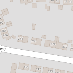


Leaflet © OpenStreetMap contributors
The heatmap indicates the level of crime in the area. The color of the heatmap indicates the crime severity and recency.
Metrics Year-on-Year
- Average area value
- 281,362.00 £Decreased by 5.90 %
- Average area rental value
- 893.00 £/moIncreased by 11.21 %
- Est rental Yield
- 3.81 %Increased by 18.32 %
- Crime Rate
- 12.00 %Unchanged by 0.00 %
from 299,019.00 £
from 803.00 £/mo
from 3.22 %
from 12.00 %
Nearby Schools
| Name | Type | Ofsted | Distance |
|---|---|---|---|
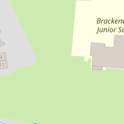
| Brackenwood Junior School | Academy Converter | 0.27 KM | |
| Wirral Grammar School For Girls | Academy Converter | 0.58 KM | |
| Brackenwood Infant School | Community School | Outstanding | 0.59 KM |
| Co-Op Academy Bebington | Academy Sponsor Led | 0.61 KM | |
| Wirral Grammar School For Boys | Academy Converter | 0.71 KM |
Images
Nearby Streets
| Name | Average Price | Average Sqft | Distance |
|---|---|---|---|
| Hazel Grove | £ 240,000 | 0 | 0.00 KM |
| Lime Avenue | £ 230,000 | 0 | 0.00 KM |
| St Edmunds Road | £ 420,000 | 0 | 0.00 KM |
| Patterdale Road | £ 0 | 0 | 0.00 KM |
| Kendal Close | £ 235,000 | 0 | 0.00 KM |
Nearby Transport
| Name | NLC | TLC | Distance |
|---|---|---|---|
| Bebington | 2188 | BEB | 1.95 KM |
| Port Sunlight | 2198 | PSL | 2.34 KM |
| Rock Ferry | 2189 | RFY | 2.73 KM |
| Spital | 2199 | SPI | 3.00 KM |
| Green Lane | 2218 | GNL | 3.76 KM |
Nearby Listings
| Address | Price | Type | Score | Distance |
|---|---|---|---|---|
| Heath Road, Bebington | £ 250,000 | BUY | Unknown | 0.01 KM |
| Plane Tree Road, Bebington | £ 230,000 | BUY | Unknown | 0.13 KM |
| Heath Road, Higher Bebington, Wirral | £ 280,000 | BUY | 6 / 10 | 0.16 KM |
| Plane Tree Road, Bebington | £ 225,000 | BUY | Unknown | 0.17 KM |
| Heath Road, Bebington, Wirral | £ 250,000 | BUY | 7 / 10 | 0.23 KM |
Nearby Properties
| Address | Price | Distance |
|---|---|---|
| 115 Heath Road | £ 178,000 | 0.00 KM |
| 99 Heath Road | £ 270,000 | 0.00 KM |
| 145 Heath Road | £ 105,000 | 0.00 KM |
| 153 Heath Road | £ 144,000 | 0.00 KM |
| 133 Heath Road | £ 163,250 | 0.00 KM |